Cemetery Management Streamlined with Web Mapping Application
Client: City of Omak
Location: Omak, Washington
About the Cemetery Management Project
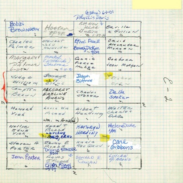
When City of Omak needed a new cemetery management system, they reached out to FLO for help. Although based on a GIS system, the software the City was using was no longer supported by modern computer operating systems, leaving the City to move their management system offline. Office staff had resorted to using paper maps, making it difficult to locate information quickly and to synchronize the maps with cemetery site records. Relying on paper records also left the system vulnerable to human error (such as misreading someone’s handwriting) and to all the risks involved with storing important information on paper—risk posed by natural disasters, for instance. Working with FLO through the Association of Washington Cities GIS Consortium, City of Omak moved from a cumbersome cemetery management system to a user-friendly web map and web application that allow staff to easily track and manage all grave information from any device.
Meet the Client
City of Omak is a small rural city of about 4,700 residents in north-central Washington State.
Web Map Creation
Using a mix of existing data and newly scanned records, we created new GIS polygon layers delineating the cemetery blocks and graves of the City’s cemetery. The data and application were all hosted and built in the City’s ArcGIS Online account to ensure that staff would have full ownership of the final web application.
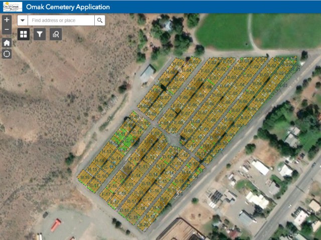
Digitizing the Information
To ensure that the new web application provided the City with access to all current burial, we extracted and converted the old GIS data, and cross referenced the contents with photocopies of their paper records. In this way we could capture any updates and verify the current state of the geometry. At the same time, we established a new set of data fields and standardized several values so that entry was simple and consistent.
Connecting Survey 123
To make the cemetery information editing process as straightforward as possible, we connected the new digital cemetery data to Esri’s Survey123 application, a tool that seamlessly connects to ArcGIS data to make it easy to edit the information in the map. The form is mobile-friendly and guides the user as to what information is required, streamlining input. All cemetery information remains editable within the web map as well, for users who are comfortable with that approach.


Their Thoughts
“FLO has not only helped us go from hard copy mapping to electronic GIS but has also upgraded our outdated Cemetery mapping system. I would absolutely recommend FLO to colleagues, as they are great at communication and were quick to understand our needs.”
-Ken Mears, City of Omak Public Works Director
Our Thoughts
“The City was struggling when their old application died and now the application hosted in their own environment can be used by office or cemetery staff easily, and a public facing app can be created with no extra cost.”
-Ruth McColly, Senior GIS Analyst
Explore Our Work
-
City of Roseville Redistricting
Client: City of Roseville
-
City of Reno Redistricting
Client: City of Reno
-
City of New Orleans Redistricting
Client: City of New Orleans