Development Activity Map Builds Data Transparency
Client: City of Sammamish
Location: Sammamish, Washington
About the Project
The City of Sammamish is experiencing a high rate of population growth, spurring a surge of building construction in the area. City leaders identified two challenges exacerbated by the increase in development: citizens were frustrated that it was so difficult to access information about development in their community, and the city’s community development staff did not have an easy way to view and edit permit information on a map and share updates with other departments such as public works. Working collaboratively with Sammamish’s city manager and GIS coordinator, FLO built a web map that tracks development activity within city limits. The web map now provides easy access to development activity information for the community and serves as a useful tool for communication and collaboration among city staff.
Meet the Client
The City of Sammamish, a community of around 65,000 residents, is located above Lake Sammamish on the Sammamish Plateau in King County, Washington. The city borders the communities of Issaquah to the south and Redmond to the north, and is near the major urban areas of Seattle and Bellevue.
Streamlining Systems and Building the Web Map
We created the development activity map by first assessing the city’s existing GIS infrastructure and TRAKiT software permitting system to see if information from both could be combined and visualized on a web map. We determined that there was no TRAKiT GIS integration tool available that would achieve our goal, so we proceeded with a custom solution. As the TRAKiT and GIS data were both stored in SQL Server databases, we built database views and procedures to securely connect the key permit information with the land parcel location.
Using ArcGIS Online, we quickly built a web map that visualizes the combined GIS and TRAKiT data. The integrated data are served to the web through ArcGIS Server registered on the city’s ArcGIS Online account, ensuring that the city has full ownership of the map and allowing city staff to easily modify and adjust the application through built-in tools. Edits to development permits in the system automatically update the data underlying the web map, which can be accessed from a tablet, smartphone, or computer.
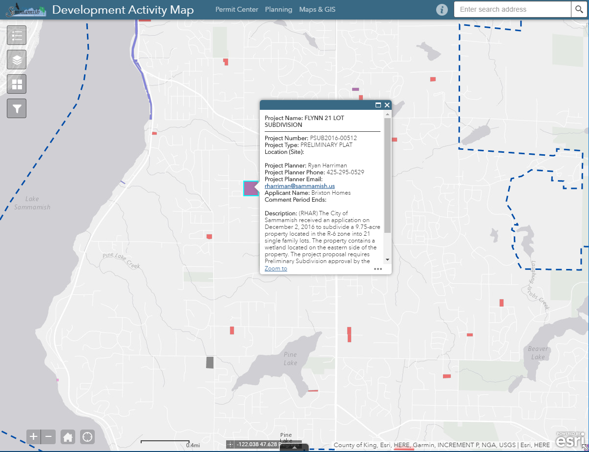
Development Activity Available 24/7
With the development activity map online, Sammamish staff can easily access development activity information—and so can residents. With just a few clicks, anyone can see permitted development activity in the city, details about the development, and whom to contact if they want to learn more—a new tool welcomed by the community, if the Sammamish community newsletter’s introduction to the development activity map is any indicator:
“When big public notice signs appear on empty parcels, they serve to irritate some people twice. Once because it usually means more homes are going up. And a second time because they can’t read the information as they whiz by in their cars. So, in response to numerous requests, the city now has a ‘development activity map’ on its website.”
Want to explore the City of Sammamish’s development activity map?
City of Sammamish is a member of the Association of Cities GIS Consortium, a program that works to improve access to GIS services for Washington communities. Learn more about the AWC GIS Consortium.
Their Thoughts
“Having someone with the knowledge of a database administrator was really essential in making this work. We did not have that expertise in-house, and that’s what FLO Analytics brought to the equation.”
—David Pyle, Deputy Director of Community Development, City of Sammamish
Our Thoughts
“The city wanted to deliver up-to-date data in an easy-to-use format with minimal maintenance requirements. SQL views and procedures allowed us to combine data cleanly, securely, and automatically from both the TRAKiT and GIS systems without impacting the use of either, and the map can be managed directly by the city without requiring coding skills.”
—Grant Herbert, Director of Technology
Contact Us

Grant Herbert, GISP
Director of Technology
(206) 556-2024
Explore More Projects
-
UAS Deployed for Disaster Documentation
Client: City of Ellensburg
-
GIS Strategic Plan Sets Up a City’s GIS Program for Success
Client: City of Pullman
-
GIS Program Development
Client: Columbia Land Trust