AWC GIS Consortium Gains New Members From All Over the Map
Author: Tyler Vick Published: September 25, 2019The Association of Washington Cities (AWC) GIS Consortium continues to gain members from all corners of Washington State, representing the diverse GIS and data needs of Washington communities large and small. Read on to learn about how FLO, the Consortium GIS service provider, is assisting the cities of Pasco, Port Orchard, Harrington, Eatonville, and Sultan with their GIS and data needs. If you’re a Washington municipality or special district, you’re eligible to join the program. Learn more about the AWC GIS Consortium.
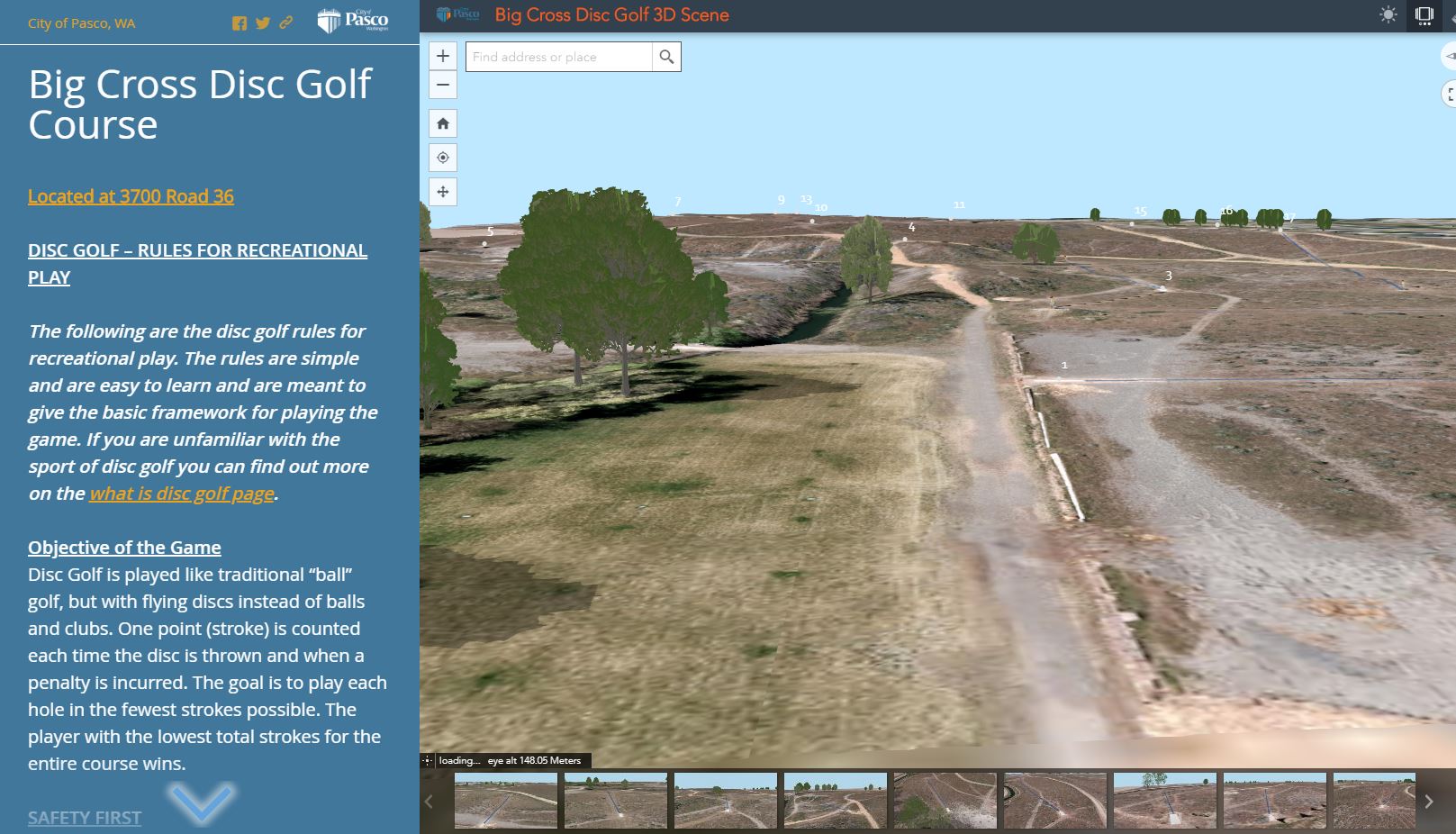
City of Pasco | Population: 73,000 | Tier 1 Member
City of Pasco wanted to showcase a new public park and disc golf course to highlight the new amenity for citizens and provide them with information about how to play and rules of the game. Working with high-resolution imagery previously captured by city staff, we created a 3D Web map that highlights each hole of the disc golf course so citizens can explore the course before they head there to play from any computer, tablet, or mobile smartphone.
Port Orchard | Population: 14,000 | Tier 1 Member
FLO recently assisted Port Orchard with installing ArcGIS Enterprise, allowing staff to keep utility data organized in a secure online location, and create Web maps that allow staff to interact with and analyze the data. We are now assisting them with training initiatives focused on Esri’s Web AppBuilder and ArcGIS Pro.
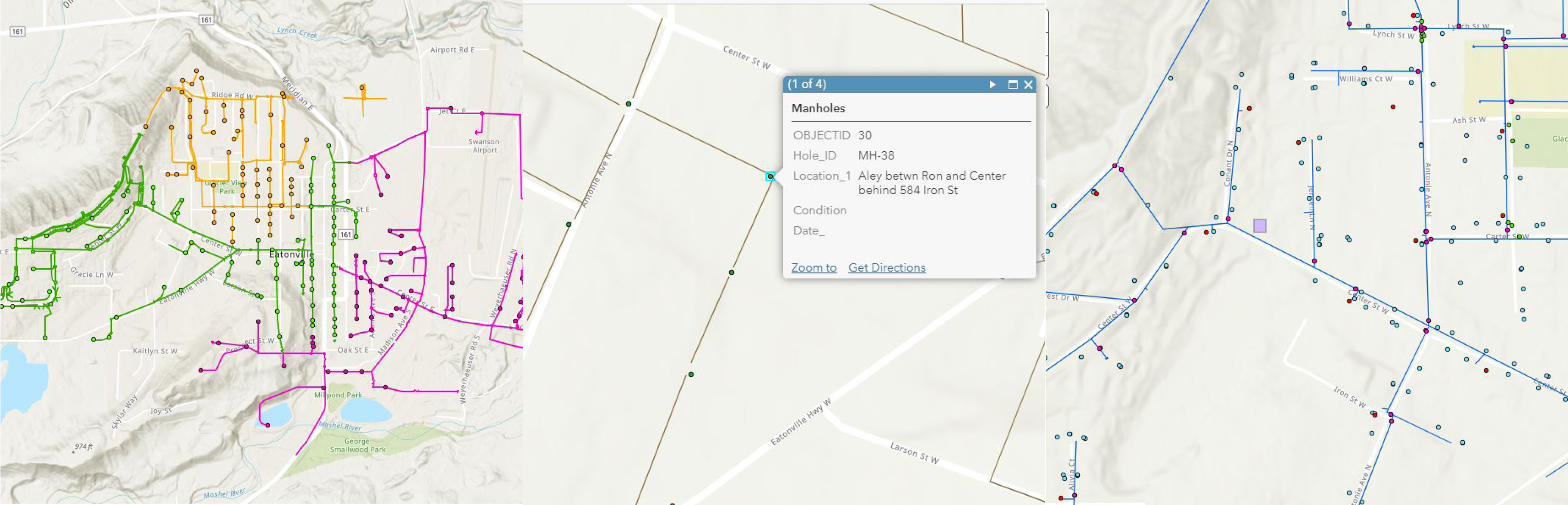
City of Harrington | Tier 2 Member
Although paper maps have advantages, digital maps and Web maps have superior capabilities when it comes to analysis, editing, and sharing. Currently, about 25% of the city’s data is in paper maps, and we are assisting the city in converting those paper maps into a digital format. We are also working with the city to collect public-works-related field data to ensure that any institutional knowledge held by public works staff persons retiring soon will be captured before they leave.
City of Eatonville | Population: 3,000 | Tier 4 Member
Although City of Eatonville has not employed a GIS staff person since around 2008, the city has a wealth of useful water, sewer, storm and electrical utility GIS data. FLO is helping the city utilize those data, managing an ArcGIS Online Organizational account to ensure that all data are organized and readily available for city staff to review. We are also in the process of creating several Web maps for internal staff to use to analyze and track assets. With the imminent retirement of a leader on their electrical utility team, we are also assisting the city in digitizing and organizing that staff member’s critical institutional asset knowledge and setting up a system to help the city centralize asset knowledge going forward.
City of Sultan | Population: 5,100 | Tier 4
The newest member of the AWC GIS Consortium joined to get help setting up a GIS program, as the majority of the city’s data is in paper map form, and the city does not employee any GIS staff. We will work with the city’s public works manager and public works staff to set up a GIS that can accommodate the city’s needs and provide training on how to use GIS and maintain the systems that keep data organized.
Contact Us

Grant Herbert, GISP
Director of Technology
(206) 556-2024